The only thing left to do is create the shapefiles for my client and send them, with the maps, to him.
Hope everyone has a great summer!
-Madeline Santulli
Tuesday, April 30, 2013
What has been done:
made the borders of the preserve and set up a side map to show where the location of the preserve is in regards to the county of Rensselaer.
contacted Nick Conrad to determine which coordinates are to be used as the stream and what ones are to be used as the trails of the preserve.
What needs to be done:
make the trails and stream lines
prepare shapefiles for Nick Conrad to use for future reference
make the map presentable and organized enough so anyone can use it
Tuesday, April 23, 2013
What has been done:
Finished tutorial 12
Reformatted the map to Nick Conrad's preference, while also creating the formatting of the map for presentation in class.
What will be done:
Editing the map to the factors I learned from Ch. 12 Tutorial
Tuesday, April 16, 2013
What has been done:
Half of Tutorial 12
Contacted Nick Conrad regarding the format of the map.
What needs to be done:
Finish Tutorial 12
Finish layer, displaying only Rensselaer County.
Tuesday, April 9, 2013
What has been done:
Started Chapter 12 Tutorial to find a way to mark the boundaries of the preserve.
Added roads and rivers to the map.
What needs to be done:
Finish chapter 12 tutorial, and create boundary.
Finish layer, displaying only Rensselaer County.
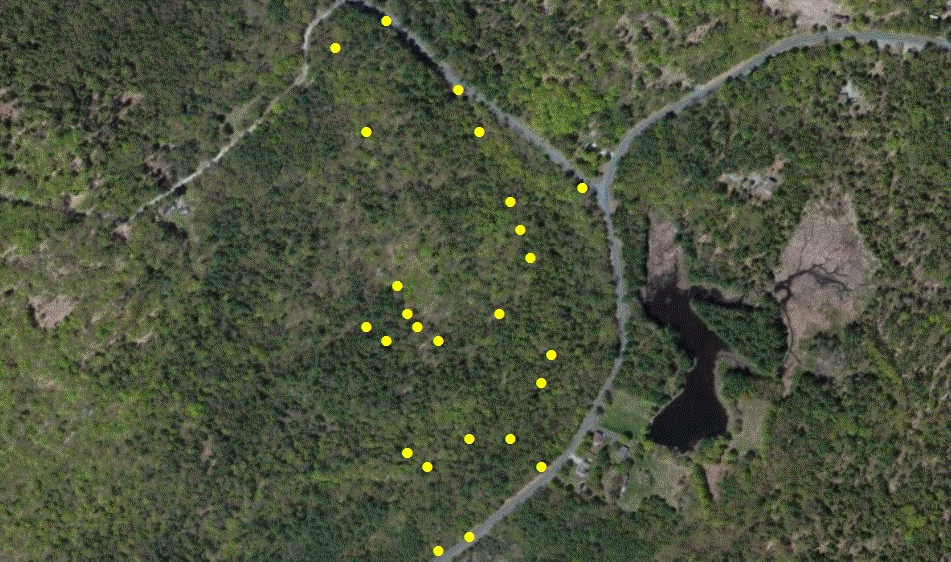
Tuesday, April 2, 2013
What has been done:
Integrated the GPS coordinates into the map.
What is needed to be done next week:
Learn how to edit the map by doing chapter 12 tutorials.
Integrate maps into one (do chapter 7 tutorial).
Tuesday, March 19, 2013
19 March 2013
What has been done:
All maps needed to assemble the overall map have been collected.
Went to Ingalls Preserve and recorded the GPS coordinates of certain features of the preserve with Nick Conrad.
What is to be done by next week:
All layers will be put into one to make the overall map.
If possible, integrate the GPS coordinates into the map to show the locations of the special features in the preserve.
To do all of this, I will have to meet with professor Meierdiercks, concerning with the maintenance of the ArcGIS software on my personal computer.
Have professor Meierdiercks help to get the tax parcel for the Ingalls Preserve.